

Little River
Cadiz Water Trail
Adventures on Kayak or Canoe
Serene Paddling in Cadiz
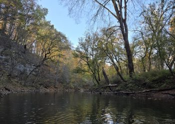
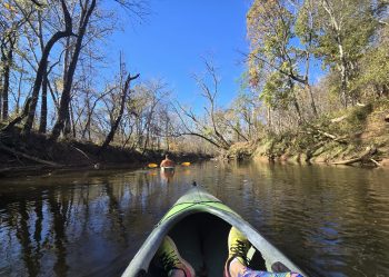
Experience the serenity of Little River with a self-guided kayaking or canoeing adventure in Cadiz, Ky. This gentle waterway provides a peaceful escape for paddlers of all experience levels, perfect for exploring the region’s natural charm. Glide through calm waters, observe local wildlife, and discover hidden coves, caves and a waterfall along the riverbanks, creating unforgettable memories.
Important Note: This kayaking experience requires two vehicles. One vehicle should be left at the designated take-out point, and the other at the put-in point. Participants should also expect to carry their boats to and from the water’s edge. Prioritizing personal safety is essential; we strongly recommend wearing life vests and being mindful of water conditions.
We also encourage all paddlers to respect the delicate ecosystem of Little River by practicing ‘leave no trace’ principles: pack out what you pack in, stay on the water, and minimize your environmental impact. Do not enter any caves.
Enjoy the tranquility of Little River at your own pace, adding a memorable, eco-conscious kayaking trip to your list of things to do in Cadiz and gaining a unique perspective on the area’s scenic landscapes.
Prepare for Your Trip
What to Bring
To fully enjoy your Little River paddling experience, come prepared for a day on the water. The following list includes essential items and helpful suggestions, but is not exhaustive, so tailor your packing to your specific needs and comfort.
- Two Vehicles: For shuttle service to put-in and take-out points.
- Kayak or Canoe: Your own or rented.
- Paddles: Appropriate size and type for your craft.
- Life Vest (PFD): Properly fitted and worn at all times.
- Waterproof Bag or Container: To protect electronics, valuables, and snacks.
- Drinking Water: Plenty to stay hydrated.
- Snacks or Lunch: Energy bars, sandwiches, fruit, etc.
- Sun Protection: Sunscreen, hats and sun glasses
- First-Aid Kit: For minor injuries.
- Map or GPS: If you're unfamiliar with the river.
- Trash Bag: To pack out any waste.
- Stay Dry: Change of clothes / towel.
- Bug Spray: Mosquito repellent is a must-have.
Where to Launch & Exit
Paddling Excursions
Always check River Conditions before you head out. Watch for hazards such as bridge abutments, old concrete structures, fallen trees, and large rocks. The information below is from the Western Kentucky Kayak & Canoe group. You can view the map below the info cards for the In/Exit points.
Entire River - 12 Mile Paddle
Trip Time: Up to 6 hours
Put In: Highway 117 (36.74281, -87.57586)
Exit: Highway 164 (36.75485, -87.6252)
Map: See map below for In/Exit points.
This long trip features small bluffs, some rapids, and a total descent of 51 feet. There are aso several caves on this route, but exploring the caves is discouraged. There is also an old dam that was destroyed near Highway 287 that can be challenging to go over. The Highway 117 entrance is NOT improved and there is very limited parking. Access here can be tricky with the steep bank.
PeeDee - 5 Mile Paddle
Trip Time: 2-3 hours
Put In: Highway 164 (36.75485, -87.6252)
Exit: Hardy Road (36.77779, -87.72508)
Map: See map below for In/Exit points.
Putting in is easy on Highway 164 with parking for 5-10 vehicles. The exit is just before the Hardy Road bridge. On this paddle trip, there is a large cave and spring about halfway through the trip. Exploring the cave is discouraged.
Hardy Road - 10 Mile Paddle
Trip Time: 3-4 hours
Put In: Hardy Road (36.77779, -87.72508)
Exit: Highway 272 (36.84015, -87.77708)
Map: See map below for In/Exit points.
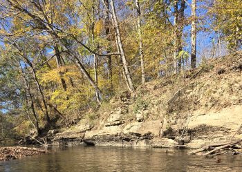
Little River flows a little faster when the water is a up a bit which are fun and will require your attention to your paddling skills. Always pay attention to fallen trees, which may be just under the surface of the river. You can see limestone cliffs, caves, and hanging gardens along the route.
Highway 272 - 1.3 Mile Paddle
Trip Time: 1 hour
Put In: Highway 272 (36.84015, -87.77708)
Exit: Glenwood Mill Road (36.84365, -87.78515)
Map: See map below for In/Exit points.
Lots of room to put in on Highway 272 with a concrete kayak ramp. This is a short paddle trip with the exit point at Glenwood Mill Road. Wildlife and birds are common along this route. The exit point has stairs to climb up to the small parking area at the road.
Glenwood Mill Road - 4.9 Mile Paddle
Trip Time: 2-3 hours
Put In: Glenwood Mill Road (36.84365, -87.78515)
Exit: West City Park (36.85780,-87.84391)
Map: See map below for In/Exit points.
Glenwood Mill Road bridge has parking for about 3-5 vehicles. On this trip, you’ll travel all the way to West End City Park in Cadiz. You’ll find an old stone bridge abutment, a relic of a previous bridge that crossed the river decades ago.
West End City Park - 8.4 Mile Paddle
Trip Time: 4-6 hours
Put In: West City Park (36.85780,-87.84391)
Exit: Meschan Bridge Boat Ramp (36.87136,-87.89544)
Map: See map below for In/Exit points.
This trip starts at West City Park and travels down the Little River as it opens up to the lake. The in/exit points feature several parking spots. In the winter months, it’s a good idea to stay in the creek channel of the lake during winter pool water levels.
Will Jackson Road - 5.4 Mile Paddle
Trip Time: 2-3 hours
Put In: Will Jackson Road (36.90506, -87.86386)
Exit: Meschan Bridge Boat Ramp (36.87136,-87.89544)
Map: See map below for In/Exit points.
Will Jackson Road crosses the Muddy Fork of Little River. At this entry point, there is room for 3-5 vehicles and crude steps down to the water. This fork of Little River also meanders until it opens up into the lake, where paddlers can exit at Meschan Bridge Boat Ramp.
Below are a few launch and exit spots. Beware that some of these spots, besides the one at West End City Park, are primitive without official parking spots or access ways. For current updates or questions about water conditions at Little River, we recommend referring to this unaffiliated Facebook group Western Ky Canoe and Kayak.